A TRACK RECORD OF SUCCCESS
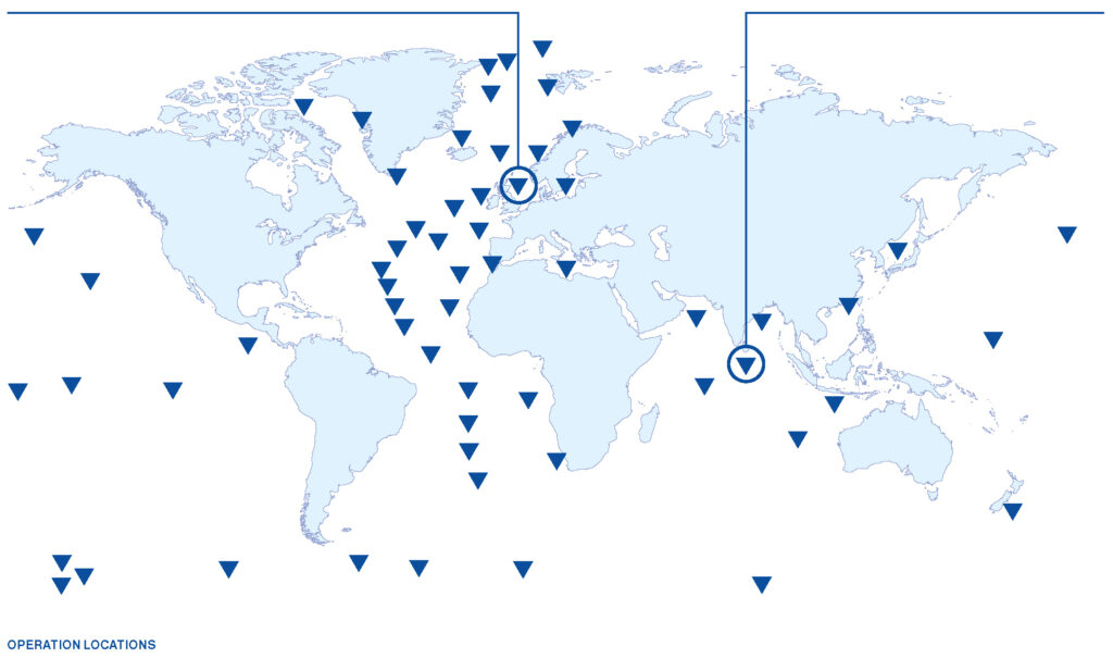
120 international marine operations. No loss of equipment. Zero injuries on our watch. Minimum downtime. Maximum data.
We plan and execute your deep sea project to the highest standards
Time on a research vessel is very expensive. Every hour onboard must be carefully planned and executed to optimise the use of time and to gain maximum data. With sophisticated research vessels, robust equipment, highly-skilled technicians and a specialist marine operations team, KUMO can provide a complete end-to-end service to safely plan and execute any subsea project.
Your complete end-to-end marine operations service
Offshore deployment of advanced technology for data acquisition or field testing requires strategic planning, a suitable vessel, robust equipment, highly-experienced marine personnel, attention to good practice and a great deal of paperwork. We execute all deployment and recovery activities on your behalf to ensure maximum data acquisition. Our seamless, end-to-end marine operations service includes:
- Manuals and procedures
- Certificates, licences and insurance
- HSE and legal paperwork
- A fully-equipped and specialised research vessel
- A comprehensive plan and schedule for deployment and recovery
- Highly-skilled marine personnel and Cruise Director onboard
- Mechanical and technical support
- Maximum data collection
- A specialist contact directly available to update you
World-leaders in marine research and subsea engineering
With 25 years’ experience, KUMO delivers safe, precise and cost-effective marine operations tailored to your specific requirements. We deploy subsea data acquisition systems for academic research centres that require bespoke equipment for their projects. We also field test our own and other’s advanced innovations during product development. We charter specialised research or simple supply vessels from any country, partnering with our trusted ship brokers.
Fully tested advanced subsea innovations
Subsea product development goes hand in hand with field testing. KUMO ensures all products are vigorously tested in our advanced research and development facility. Our ethical approach to business and attention to detail are instrumental to our core values. We will coordinate all deployment and recovery activities for your marine project. Our additional services include:
- Actual or simulated offshore deployment
- A comprehensive test plan and schedule for deployment and recovery, including risk assessment
- Evaluation of the operation against strict regulations and specifications
- Tailored project plan to ensure your specific requirements are met to the highest of standards
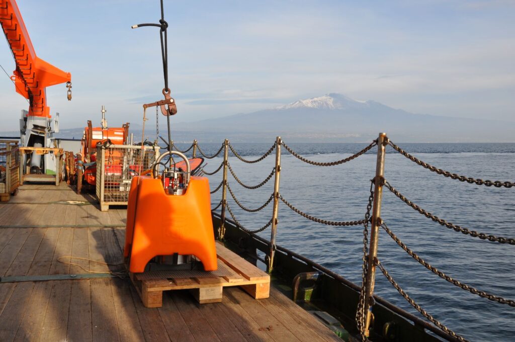
Old friends - Nammu and Ätna

CASE STUDY 1
In February 2019, we played an integral part in a week-long offshore oil and gas passive seismic appraisal campaign in the North Sea funded by an oil & gas super-major and a UK technology innovation agency.

CASE STUDY 2
In May 2018, we participated in a multi-institutional project aimed at studying a 106 m anomaly south of the Indian peninsula – the largest equipotential gravitational field distortion in the world.
Snapshots
February 2019
In this project, a total of 25 Ocean Bottom Seismometers (OBSs) previously successfully deployed in academic studies proved equally effective at collecting seismic data in a blind survey of a 3.3 km2 area of the North Sea that featured an oil-water contact line. Thanks to the joint efforts of the diving support vessel crew and our engineers, all OBSs were deployed and recovered twice in winter conditions with no loss or damage.
This trial demonstrated our capability to perform an oil and gas offshore appraisal test in line with strict safety regulations while working 24/7 shifts to ensure maximum operational efficiency. Once interpreted, the data revealed how low frequency seismic can be used successfully in oil & gas exploration and appraisal.
May 2018
Funded by the Ministry of Earth Science in India, the project aimed to discover what caused the Indian Ocean Geoid Low (IOGL), its relationship with deep mantle structures and how it differs from Earth’s other geoid anomalies. Following a detailed marine geophysical reconnaissance study of the area, 17 of our NAMMU Ocean Bottom Seismometers (OBSs) were deployed twice for a period of one year to facilitate the second stage of the research.
The NAMMU was selected as the most robust and sophisticated instrument developed for deep sea data acquisition operations and capable of self-installing on the seafloor. The data captured advanced understanding of the causes of the IOGL, and will help to potentially close a long-standing global debate about its origins.
Contact us